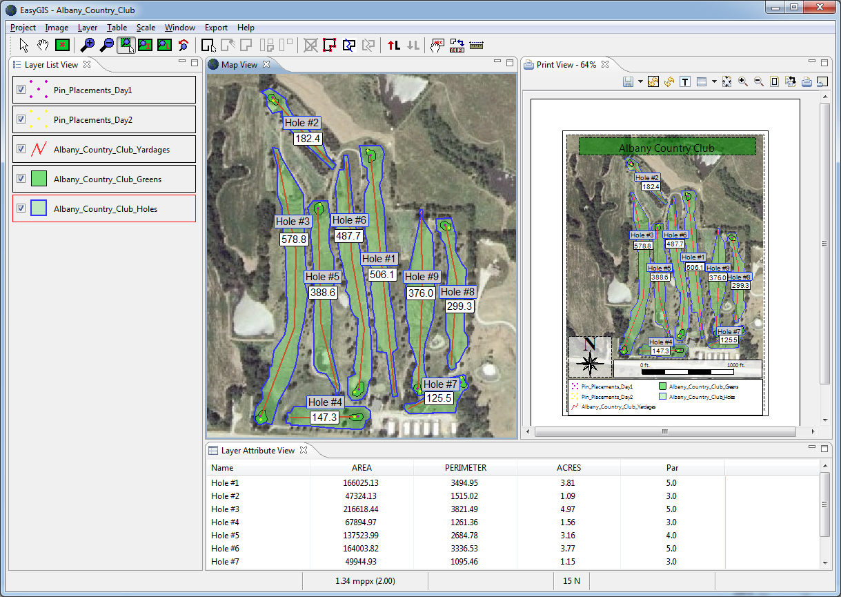
EasyGIS is a simple and intuitive GIS solution that delivers the most commonly desired features of more expensive products at a fraction of the cost.
A few of the many things you can quickly and easily with EasyGIS are:
- Draw points, polygons, and lines over aerial images
- Calculate acreages and measure distances
- Label shapes with any stored attributes such as name or area
- Separate projects into separate shape layers that can be stored and manipulated separately
- Format projects for simple and flexible printing to paper or an image
- Create and Open shapefile format files that are compatible with other GIS products such as ArcView and ArcGIS
- Convert projects to KML format for display in Google Maps and Google Earth
(here's an example)
- ...and much more!
We are constantly improving EasyGIS and adding new functionality. Check the release notes
page for a list of our latest additions.
*** Free Trial now available *** - Click here to get your copy today.
|
Click for full size screenshot
Click for full size screenshot
|